Rain chances remain as Tropical Storm Bertha tiptoes west
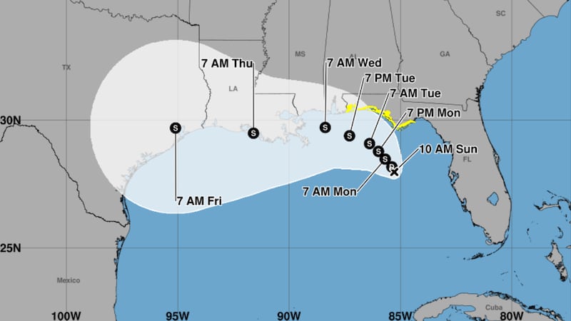
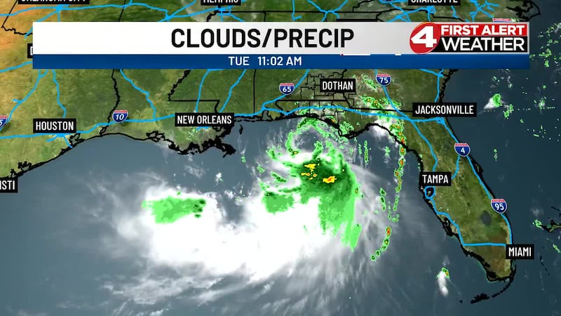
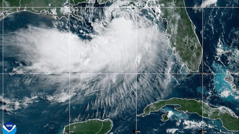
(WTVY) - Tropical Storm Bertha has taken shape just south of the Florida Panhandle, but tropical impacts inland will remain minimal as the system’s strongest winds and heaviest rain sit over the open waters of the Gulf. Bertha will continue slinging chances for scattered rain into the Wiregrass until it weakens midweek, opening the door to hotter afternoons ahead of the weekend.
Today & Tonight: Bertha Delivers Rain Chances
Today brings partly sunny skies with scattered showers and thunderstorms (50%). Highs reach 89° with east-southeast winds at 10–15 mph. Tropical Storm Bertha will sling chances for scattered rain into the Wiregrass, but tropical impacts inland will remain minimal as the system’s strongest winds and heaviest rain sit over the open waters of the Gulf.
Tonight stays partly to mostly cloudy with stray showers possible (20%). Lows drop to 75° with southeast winds at 10 mph. Rain chances decrease overnight.
Tomorrow: Scattered Storms Continue
Wednesday turns partly sunny with isolated to scattered showers and thunderstorms (40%). Highs reach 91° with south-southeast winds at 10–15 mph. Bertha continues to sling rain chances into the region.
Thursday: Bertha Weakens, Heat Returns
Thursday: Partly cloudy with a slight rain chance (20%). 75° / 94°
Bertha weakens midweek, opening the door to hotter afternoons. Rain chances drop to 20% as the system moves away and temperatures climb back to the low-to-mid 90s.
Friday & Saturday: Warming Trend Continues
Friday: Partly cloudy with isolated showers and thunderstorms (30%). 75° / 93°
Saturday: Partly sunny with scattered showers and thunderstorms (40%). 76° / 91°
As Bertha weakens, hotter afternoons develop ahead of the weekend. Isolated to scattered showers and thunderstorms remain possible at 30–40%, but the heat is building with highs in the low-to-mid 90s.
Sunday & Monday: Heat Dominates
Sunday: Partly cloudy with isolated showers and thunderstorms (30%). 75° / 94°
Monday: Mostly sunny to partly cloudy with a slight rain chance (10%). 76° / 96°
Hotter afternoons dominate as Bertha fades. Rain chances decrease significantly to just 10% by Monday. Highs climb to 96° as the heat takes center stage after the weekend.
Bottom line: Tropical Storm Bertha brings scattered rain with minimal tropical impacts inland. As the system weakens midweek, rain chances decrease and hotter afternoons develop, with heat building toward the weekend.
Download the WTVY News4 app to get alerts and stories the moment they are published. Available for FREE in the Apple App Store and the Google Play Store!
Copyright 2026 WTVY. All rights reserved.