Google adding augmented reality feature to Maps
Courtesy: Google / CNN(WTVY News 4)
Published: May 9, 2018 at 4:29 AM CDT
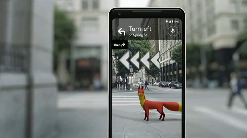
Google is introducing a navigation system feature with its Google Maps app that uses augmented reality to help guide people to their destination.
When Google Maps users pull up directions, they can look through their camera in Maps and get turn-by-turn directions while viewing the actual street. They can also get information about buildings and shops that can be seen through the camera.
Google says the technology is called VPS, or visual positioning system. It was unveiled Tuesday at the company's annual developers conference in Mountain View, California.